Knowledge Acquisition from Sparse Mobile Probe Data
Extracting durable environmental knowledge from sparse, incidental observations made by vehicles going about their business.
Image: Ranulfo Bezerra
Autonomous driving systems in urban environments are limited less by their sensors than by what they know in advance. This project extracted high-level, reusable knowledge from sparse mobile probe data across three connected tasks: analysing pedestrian flow for safer navigation, identifying the causes of vehicle behaviour changes area by area, and recognising traffic regions from driving logs without visual information. It established the pattern the current program generalises — that a shared prior about the world, built from many partial observations, is worth more than any single agent’s live perception.
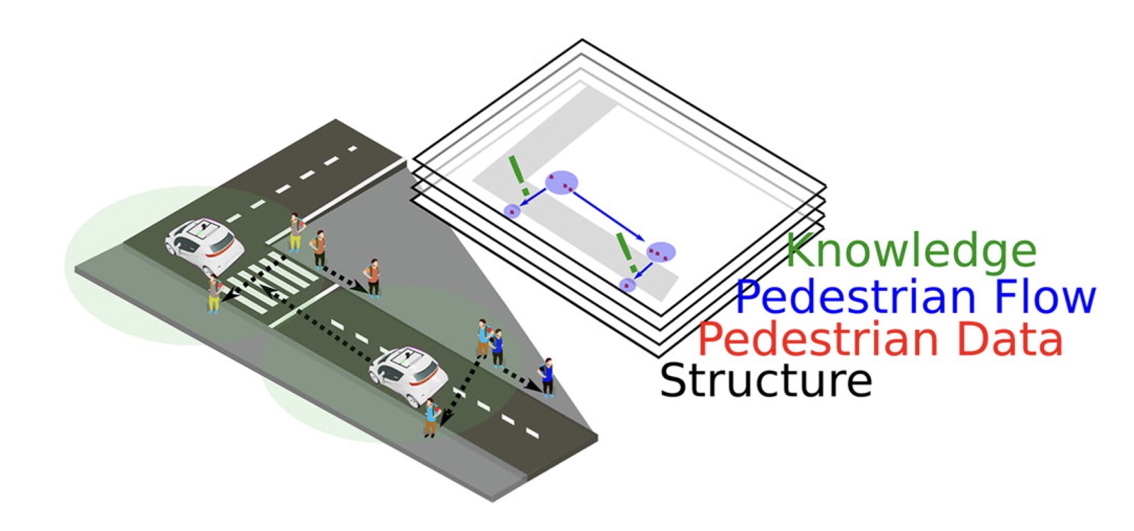
Autonomous vehicles require high-level semantic maps, which contain the activities of pedestrians and cars, to ensure safe navigation. High-level semantics can be obtained from mobile probe sensor data. Analyzing pedestrian trajectories obtained from mobile probe data is an effective approach to avoid collisions between autonomous vehicles and pedestrians. Such analyses of pedestrian trajectories can generate new information such as pedestrian behaviors in violation of traffic regulations. However, pedestrian trajectories obtained from mobile probe data significantly sparse and noisy, making it challenging to analyze pedestrian activity. To address this issue, we propose multiple daily data and graph-based approaches to treat sparse and noisy data for estimating the flow of pedestrians based on mobile probe data. To improve the sparseness of the data, multiple daily data are fused. After that, a pedestrian graph is created to enhance the region’s coverage by connecting the sparse data indicating the flow of pedestrians. This proposed approach successfully obtained pedestrian trajectory data from the sparse and noisy data. Moreover, it was possible to identify the potential locations where pedestrians tend to cross the street by analyzing the pedestrian flow. The results indicate that 83% of well-known regions where pedestrians tend to cross the street corresponded with those extracted using the proposed approach. Furthermore, a high-level semantic map of the regions where pedestrians tend to cross the street along a 1-km road is presented. The trajectory information obtained using the proposed approach is expected to be essential for understanding different scenarios of the interactions between individuals and autonomous vehicles.
Automated Driving Systems (ADSs) are being proposed as a promising technology that will help drivers avoid accidents, as well as reduce driving-related stress. To enhance the driving performance of ADSs, driving log data from human drivers is being used to teach these systems how to behave in different traffic regions. Visual information from the driving log data is an easy method to identify traffic regions. However, due to space constraints or lack of visual sensors, most of the driving log data has no visual information. Therefore, another solution is necessary to identify traffic regions using only spatial information. To address this challenge, the paper proposes a region recognition method using key primitive transitions obtained from vehicle trajectory information. To obtain the motion primitives, we employed a hierarchical similarity clustering that combines hierarchical clustering and HDP-HSMM. The vehicle behavior from the region of interest was extracted by analyzing the motion primitives transitions located within close range (50 m) of the region. We assessed the behavior of vehicles when approaching two regions: traffic lights and entrances. Three environments were used to evaluate the proposed method, with two different drivers and distinguished layouts. This study shows that the proposed classification method can identify traffic light and entrance regions with an average 89% precision and 86% f-score. Additionally, the hierarchical similarity clustering and window observation approach developed in this study is responsible for increasing the system's precision by 9%.
Ranulfo Bezerra, Kazunori Ohno, Thomas Westfechtel, Satoshi Tadokoro
ICAR 2019·Conference
Abstract +
One of the major challenges that autonomous cars are facing today is the unpredictability of pedestrian movement in urban environments. Since pedestrian data acquired by vehicles are sparse observed a pedestrian flow directed graph is proposed to understand pedestrian behavior. In this work, an autonomous electric vehicle is employed to gather LiDAR and camera data. Pedestrian tracking information and semantic information from the environment are used with a probabilistic approach to create the graph. In order to refine the graph a set of outlier removal techniques are described. The graph-based pedestrian flow shows an increase of 61.29 % of coverage zone, and the outlier removal approach successfully removed 81 % of the edges.